Shop Detail
Garmin BlueChart g3 Vision HD - VUS035R - North Alaska
  • Cost: $287.61
  • Quantity: 45
  • Free Shipping
  • Views:
  • Sold and Shipped By: eforgo

Garmin BlueChart g3 Vision HD - VUS035R - North Alaska

Coverage:

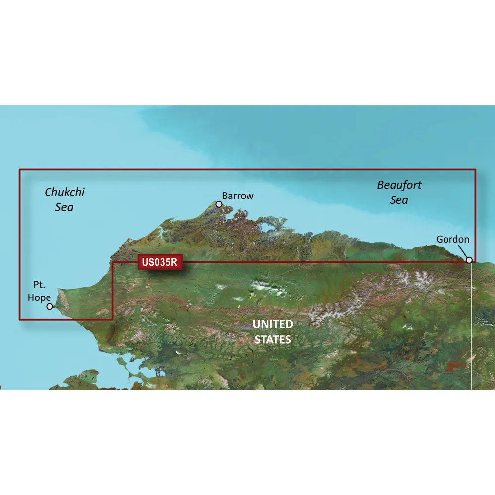
This chart provides detailed coverage of the northern coast of Alaska, from Point Hope to the United States/Canadian border, including key locations such as Point Barrow, Kaktovik, and Peard Bay.

Premier Coastal Navigation Features:

The Garmin BlueChart g3 Vision offers industry-leading navigation solutions with updated coastal charts that integrate advanced Garmin and Navionics data.

  • Employs Auto Guidance technology to calculate optimal routes based on user-defined depth and overhead clearance.
  • High-resolution relief shading enhances clarity by combining color and shadow for a more intuitive view of underwater structures.
  • Depth Range Shading offers up to 10 distinct depth ranges, allowing for quick assessments of target depths.
  • Utilizes up to 1-foot contours for precise underwater mapping, significantly improving fishing charts and navigation in complex environments like swamps, canals, and marinas.
  • NOAA Raster Cartography provides a traditional chart appearance for users preferring classic navigation visuals.
  • Includes detailed high-resolution satellite imagery for crucial navigational landmarks such as ports and bridges.
  • Offers unique 3-D viewing options through MarinerEye and FishEye perspectives for a comprehensive underwater experience.

Important Note: Auto Guidance technology is intended for planning purposes only and should not replace safe navigation practices. Raster cartography is not available for certain models but can be viewed on mobile devices using the ActiveCaptain app.

WARNING: This product may expose you to chemicals known to the State of California to cause cancer, birth defects, or other reproductive harm. For more information, visit P65Warnings.ca.gov.

Return Policy: This product may not be returned to the original point of purchase. Please contact the manufacturer directly for any issues or concerns.

  • Industry-leading coastal chart coverage and detail.
  • Integrated Garmin and Navionics data for enhanced navigation.
  • Auto Guidance technology for safe route planning.
  • High-resolution relief shading for a clearer view of underwater structures.
  • Up to 10 depth ranges for quick target depth visualization.
  • Precise underwater mapping with 1-foot contours.
  • NOAA Raster Cartography available as a free download.
  • High-resolution satellite imagery for increased situational awareness.
  • 3-D views for an enhanced perspective above and below water.