BlueChart g3 Vision HD - Les Mechins - microSD
Coverage:
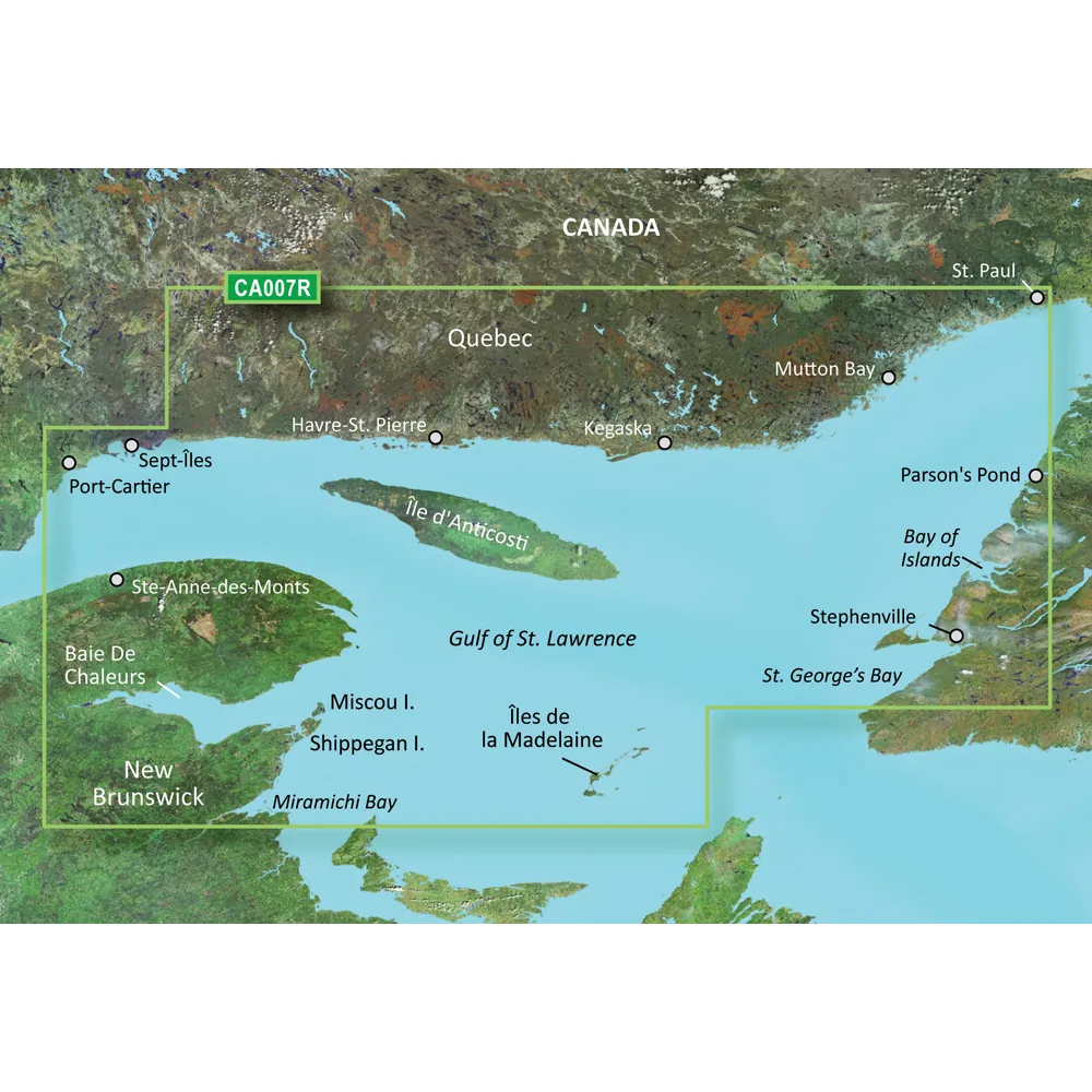
The coasts of New Brunswick and Quebec from Miramichi Bay to Les Mechins, Quebec, encompassing Chaleur Bay and the Bay of Gaspe. It also extends north along the Quebec coast from Port-Cartier to St.-Augustin, covering Sept-Iles and Havre-St.-Pierre. Additionally, the package includes Ile d'Anticosti and the St. George's Bay area of Newfoundland.
Premier Coastal Charts
Experience exceptional coverage and brilliant detail on the water with BlueChart g3 Vision coastal charts, which offer industry-leading clarity and detail.
Auto Guidance
This innovative feature enables you to select a destination and receive a route that highlights the general path and nearby obstructions at a safe depth.
Depth Range Shading
High-resolution Depth Range Shading for up to 10 depth ranges allows you to clearly view your selected target depth.
Shallow Water Shading
This feature visually represents shallow waters to be avoided, offering shading based on user-defined depths.
Detailed Contours
BlueChart g3 Vision charts display 1-foot contours for a more accurate representation of bottom structure, improving fishing and navigational detail.
High-resolution Satellite Imagery
The use of high-resolution satellite imagery superimposed with navigational charts provides a compelling view of your environment, ideal for navigating unfamiliar harbors or ports.
FishEye View
This unique underwater perspective offers a 3-D view of bottom contours, integrating sonar data for customized views.
MarinerEye View
The MarinerEye View delivers a 3-D perspective of the surroundings both above and below the waterline.
Aerial Photography
Exceptional clarity in aerial photography provides detailed views of ports, harbors, and marinas, especially useful when entering unknown ports.
WARNING: This product may expose you to chemicals known in California to cause cancer, birth defects, or other reproductive harm. For more information, visit P65Warnings.ca.gov.
This product may not be returned to the original point of purchase. Please contact the manufacturer directly for any issues or concerns.
© 2026 BrokerDen. All rights reserved.


