Garmin BlueChart g3 Vision HD - VUS020R - St. Lawrence Seaway
Coverage:
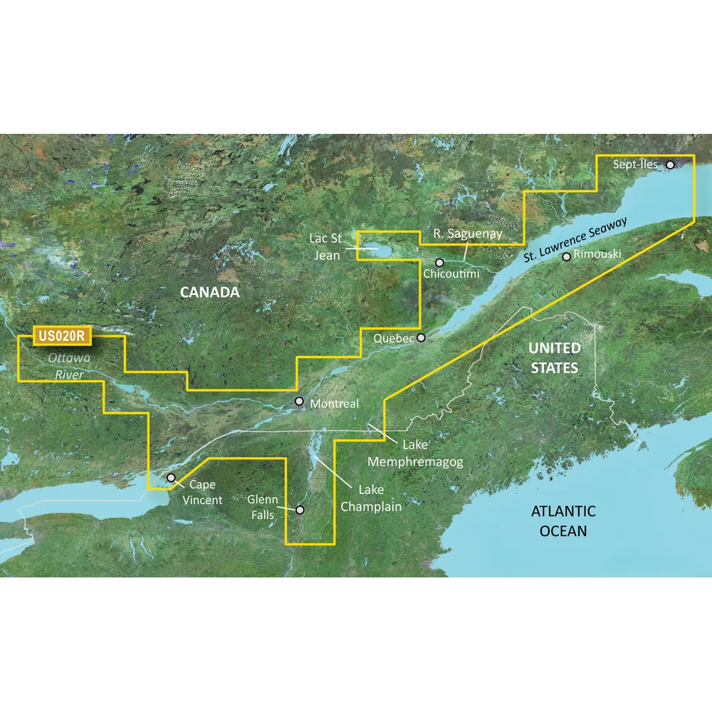
This chart provides extensive coverage of the St. Lawrence River from Brockville, Ontario to Sept-Iles, Quebec, including the city of Montreal. It also features detailed mapping of Lake Champlain and Lac Saint-Jean, alongside the Rideau River and the Ottawa River to Temiscaming. Additionally, it covers the Riviere Saguenay down to the St. Lawrence River and extends to the Hudson River up to Troy, New York.
Premier Coastal Navigation Features:
Experience unmatched clarity and detail on the water with Garmin BlueChart g3 Vision coastal charts. This product integrates top-tier navigation technology to elevate your maritime experience.
Auto Guidance Technology:
The Auto Guidance feature provides suggested routing options based on your specific depth and overhead clearance preferences.
High-resolution Relief Shading:
The relief shading feature offers an easy-to-read visual interpretation of underwater structures, enhancing navigation.
Up to 1-Foot Contours:
Contoured lines offer a more precise depiction of underwater terrain, important for fishing and safe navigation.
NOAA Raster Cartography:
For users who appreciate the look of traditional paper charts, NOAA raster cartography can be freely downloaded through the ActiveCaptain app.
Depth Range Shading:
This helpful feature displays up to 10 depth ranges for your convenience.
Shallow Water Shading:
This allows safe navigation by highlighting areas of shallow water that should be avoided.
High-resolution Satellite Imagery:
Detailed imagery of navigational points such as ports, marinas, and bridges enhances situational awareness.
Unique 3-D Views:
MarinerEye and FishEye views offer additional perspectives above and below the waterline, enhancing your on-water experience.
© Auto Guidance is for planning purposes only and does not replace safe navigation operations. Raster cartography cannot be viewed on echoMAP CHIRP and ECHOMAP Plus combos but is available on mobile devices via the ActiveCaptain app.
WARNING: This product can expose you to chemicals recognized by the State of California to cause cancer, birth defects, or other reproductive harm. For more information, visit P65Warnings.ca.gov.
This product is non-returnable to the point of purchase. Please contact the manufacturer directly for assistance.© 2026 BrokerDen. All rights reserved.


