Shop Detail
Garmin BlueChart g3 Vision HD - VUS025R - Anchorage to Juneau
  • Cost: $287.61
  • Quantity: 45
  • Free Shipping
  • Views:
  • Sold and Shipped By: eforgo

BlueChart g3 Vision HD - VUS025R - Anchorage to Juneau

Coverage:

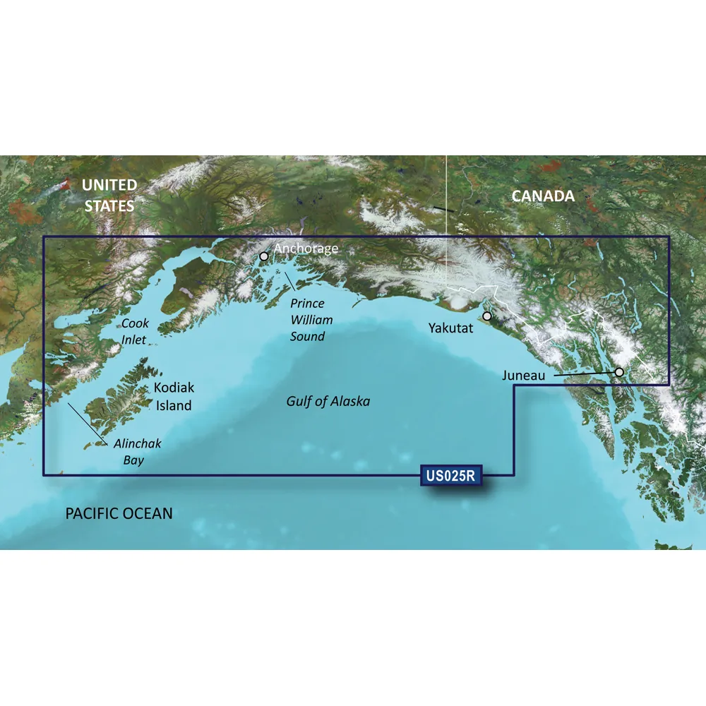
Detailed coverage extends from Juneau to Alinchak Bay, including Kodiak Island, Cook Inlet, Prince William Sound, Yakutat, Glacier Bay, and Icy Strait.

Premier Coastal Charts

  • Industry-leading coverage, clarity, and detail with updated coastal charts integrating Garmin and Navionics data.
  • Auto Guidance technology calculates routes based on your desired depth and overhead clearance to suggest a safe path.
  • High-resolution relief shading offers a clearer view of bottom structures using color and shadow, surpassing simple contour lines.
  • Depth Range Shading presents up to 10 depth ranges for quick visual targeting of depths.
  • 1-foot contours allow for more precise depiction of underwater structures, enhancing navigation and fishing opportunities in various waterways.

Experience unmatched coverage and detail on the water. BlueChart g3 Vision coastal charts seamlessly combine Garmin and Navionics data, high-resolution relief shading, and advanced Auto Guidance technologies.

Technological Features

The Auto Guidance feature is designed for planning and does not replace safe navigation strategies.

High-resolution relief shading creates a clearer visual from above and below the surface.

NOAA raster cartography is available as a free download through the ActiveCaptain app for those who prefer a paper chart appearance.

Shallow Water Shading designates depths to avoid for improved safety.

High-resolution satellite imagery enhances situational awareness with detailed renderings of ports, marinas, bridges, and landmarks.

Unique 3-D views from MarinerEye and FishEye perspectives offer greater awareness both above and beneath the waterline.

  • Industry-leading coverage and clarity with integrated Garmin and Navionics data
  • Auto Guidance technology for safe route planning
  • High-resolution relief shading for clearer underwater structure visualization
  • Convenient Depth Range Shading for quick depth identification
  • Accurate 1-foot contour lines for improved navigation
  • NOAA raster cartography for a classic paper chart look
  • High-resolution satellite imagery for enhanced situational awareness
  • Unique 3-D viewing options with MarinerEye and FishEye perspectives